Great Diamond Island shoreline erosion

Great Diamond Island Sea Level Rise Partnership

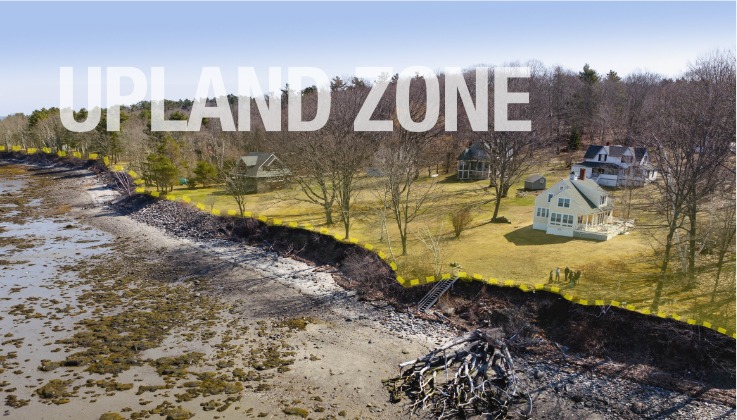
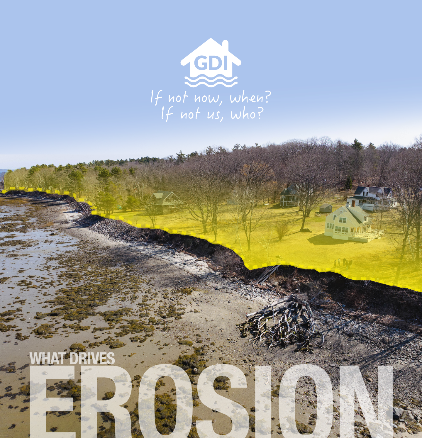
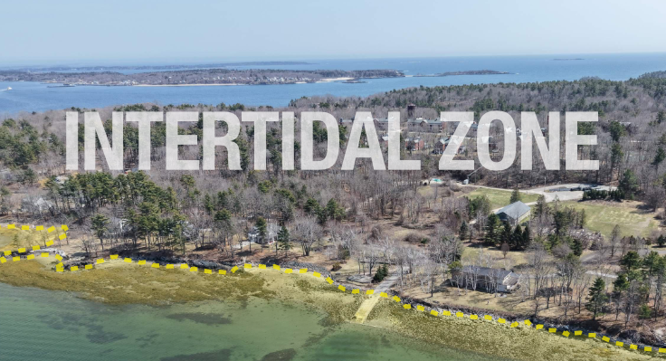
Every shoreline tells a story. Understanding what's driving erosion means looking beyond where the erosion appears. The intertidal zone, the shape and character of the shore, and upland zone can all influence how a shoreline responds. Much of GDI's erosion is driven by poor upland management. Explore the two zones below to understand what's contributing to erosion—and how proactive upland management can help reduce erosion and build long-term shoreline resilience.

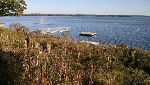
Aerial view of the Great Diamond Island shoreline
Aerial view of the upland and shoreline
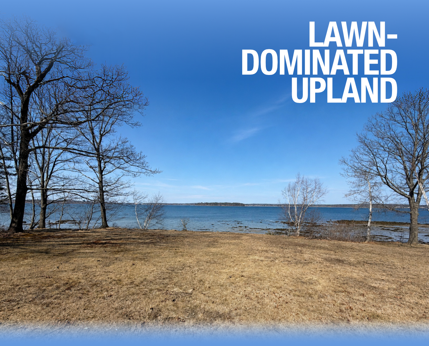
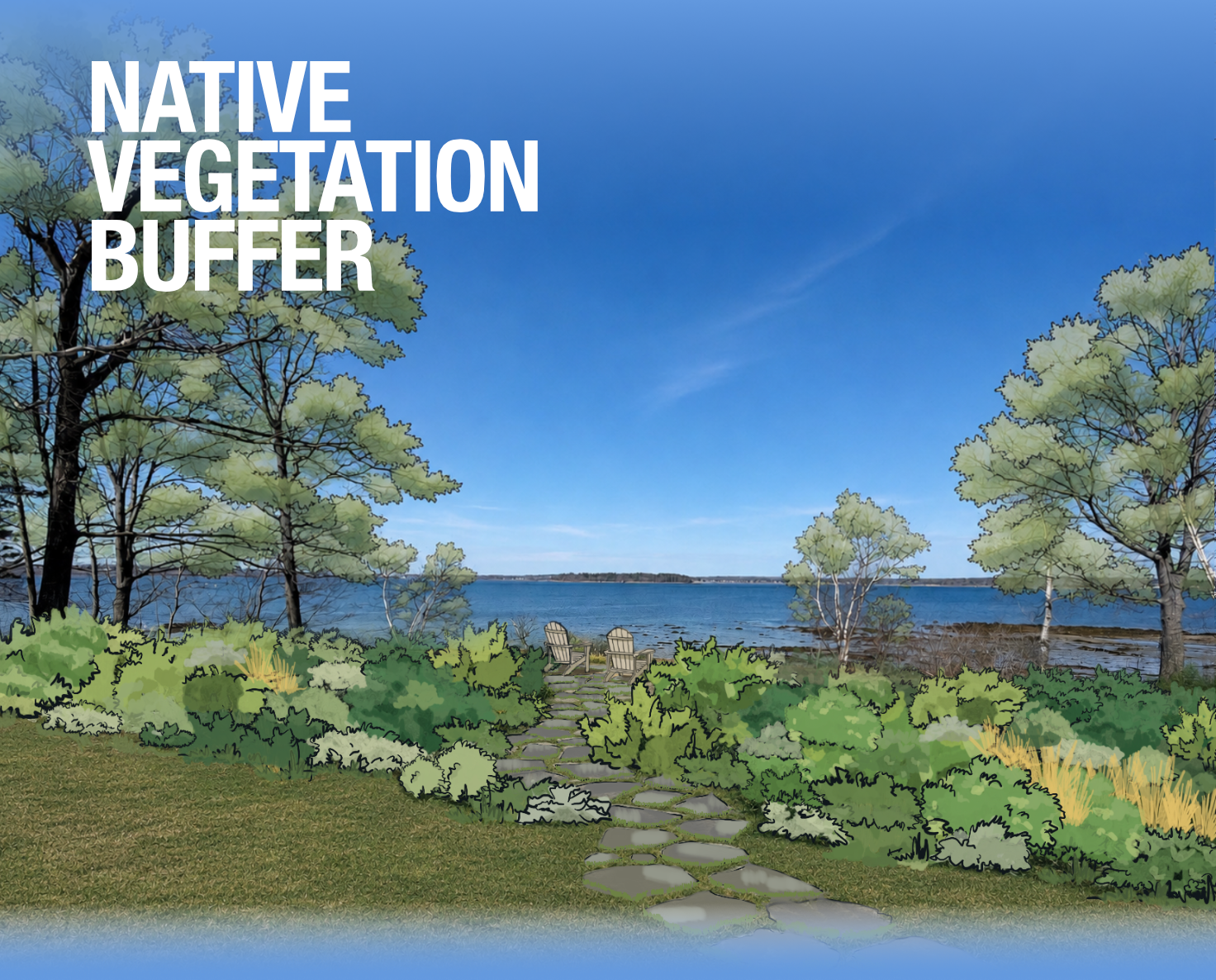
Give the bluff a buffer

When lawn extends to the bluff edge, its shallow roots provide little structure to slow and absorb water moving toward the shoreline. Slide between the two landscapes to see the difference a 10-20ft native planting buffer can make—adding deeper roots, greater plant diversity, and a more natural transition to the shoreline.

Upland with lawn
Upland with native plant buffer zone

A healthy buffer gets stronger as it grows. A mix of grasses, shrubs, and trees creates roots at different depths, building a living network that holds soil together. Even when storms damage vegetation above ground, established roots can survive and regrow.

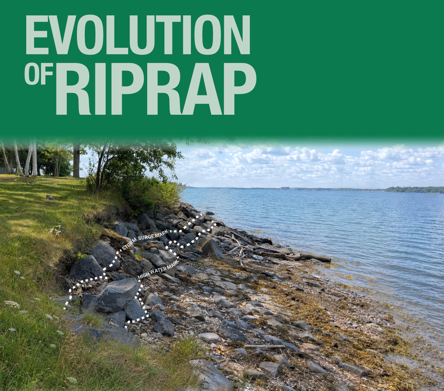
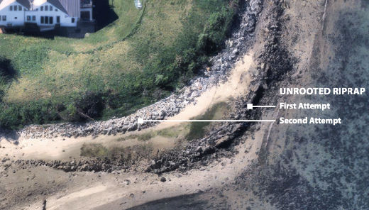
Traditional unrooted riprap along the shoreline

Decades of shoreline stabilization have challenged the idea that riprap is a permanent, “put it down and leave it” solution. While rock can provide immediate protection, traditional unrooted riprap can shift, deteriorate, and require costly repairs over time. Maine’s recent powerful storms exposed these limitations, damaging traditional riprap installations while rooted riprap fared remarkably well with little damage. Unlike rock alone, rooted systems have the added ability to recover, regenerate, and strengthen over time.

Traditional riprap places large rock over geotextile fabric. But the fabric also separates the rock from the soil below, preventing deep-rooted vegetation from anchoring the shoreline. The result? Unrooted riprap is often strongest the day it is installed—but it weakens over time.

In high-energy areas where extra protection is needed at the toe, rocks provide immediate protection while plants build strength over time. Varied root systems bind and stabilize the soil. When storms damage vegetation, established roots can regrow—creating a self-healing system that can be less costly to repair than unrooted riprap.

With rising seas and higher storm tides, you don't have to wait for nature to take its course. Coir fabric filled with organic material can be anchored within existing riprap and planted—creating the growing conditions plants need to establish years sooner and helping the bluff mature into a stronger, more resilient, rooted shoreline faster.
THE RESOURCES below take a deeper look at the forces and shoreline conditions that contribute to erosion, building on the features explored above.

OUR SHORE

The OUR SHORE Guide to Shoreline Stabilization in Maine from the DEP uses clear illustrations to explain how water, waves, geology, vegetation, and other site conditions contribute to shoreline erosion. The comprehensive guide connects these causes to practical stabilization approaches and examines how incorporating vegetation can influence long-term performance, maintenance, and lower relative costs compared with unvegetated shoreline restoration.

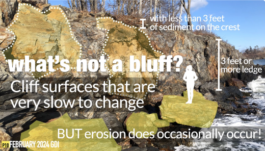
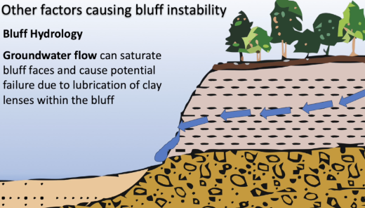
The Anatomy and Life-Cycle of a Bluff image

Want to learn more about what shapes Maine's shorelines? The Anatomy and Lifecycle of Maine's Coastal Bluffs webinar explores how Maine's shoreline is classified, how coastal bluffs form and change over time, and the many forces that contribute to erosion. Developed by the GDI Partnership and the Long Island Civic Association, with guidance from the Maine Geological Survey, it's a great next step for understanding what you're seeing along the shore—and why it matters.

2024 Calling Your Bluff Symposium Video Series

2024 CALLING YOUR BLUFF SYMPOSIUM VIDEO SERIES. Hear from coastal scientists, engineers, and practitioners as they discuss bluff erosion, shoreline stability, and practical management approaches during the Calling Your Bluff Symposium held at the Gulf of Maine Research Institute.

Cumberland County Coastal Plant Guide

Cumberland County Coastal Planting Guide. Widely recognized as a go-to resource for coastal planting in Maine, this guide identifies native plants suited to shoreline conditions, with recommendations based on soil depth, salt exposure, and water availability. It provides practical guidance for selecting vegetation to help stabilize soils and support a living shoreline.