
Use the slider below to compare present-day and future storm surge flooding. By adding the projected 2030 sea level rise of 8in to Portland's typical daily high tide, this graphic illustrates how higher baseline water levels will increase the extent of flooding during annual winter storms. As sea levels continue to rise, storm impacts that are uncommon today will become increasingly common along our island's shoreline.
Continue scrolling to watch three videos. The first shows a typical annual storm in Diamond Cove. The second two illustrate how an annual storm would look in the future as rising sea levels increase baseline water levels.
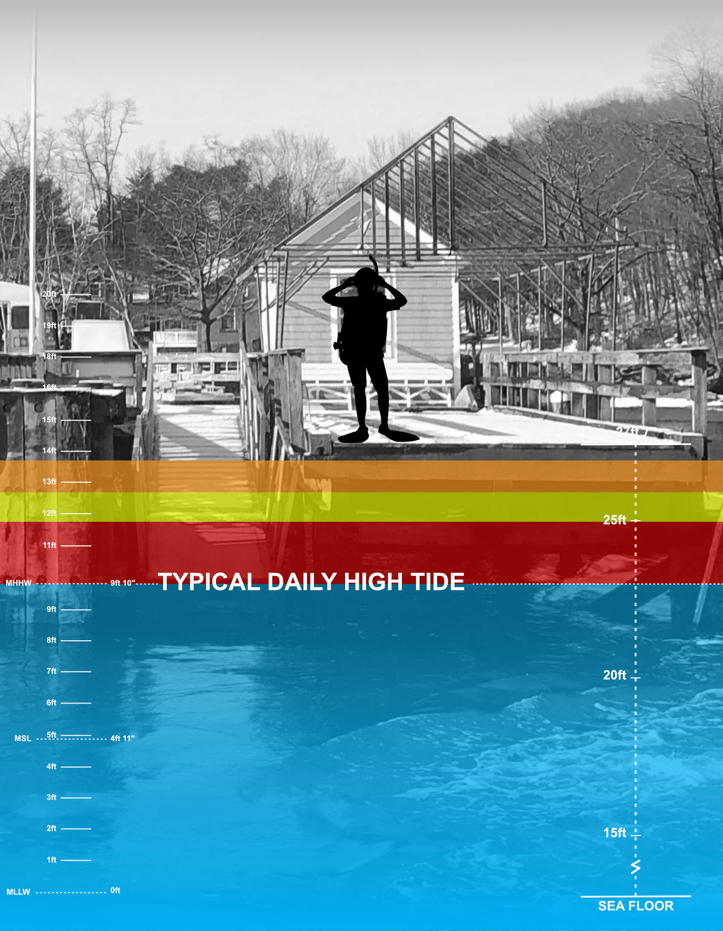
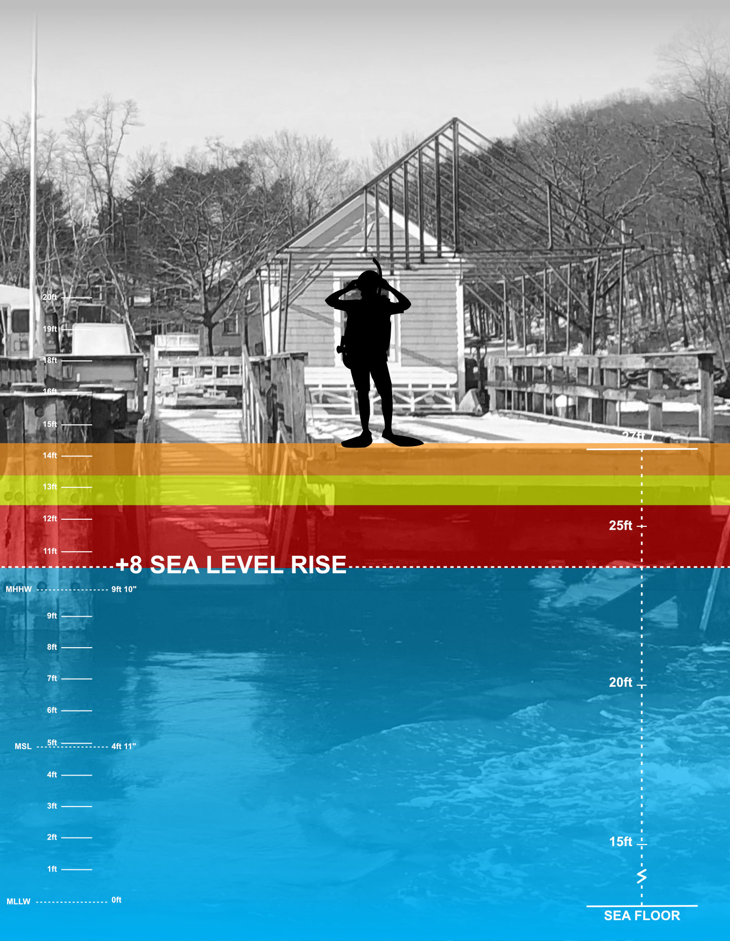
Note: The current tidal datum shown above does not yet reflect Portland's 8in of sea level rise that has already occurred. NOAA is currently updating the National Tidal Datum Epoch to account for changing sea levels, with the revised tidal datums expected to be released in 2029.

Portland's annual storm tide reaches approximately 11ft 7in, just below the city's 12ft flood stage. Portland experiences these storm surge heights:
These storm surge statistics are based on more than a century of water-level observations collected at Portland Harbor and analyzed by the Maine Geological Survey. Together, these records provide a benchmark for understanding how sea level rise will influence future storm tides and coastal flooding along Portland area shorelines.
The following video shows typical conditions during an annual winter storm at the Diamond Cove pier. The predicted tide was 10ft and the recorded storm surge was 2ft 1in, producing a storm tide around 12ft. As sea levels rise, annual storms like this will occur on top of higher baseline water levels, increasing the frequency and extent of coastal flooding.
The following videos show two significant storm events. The first features a storm with a predicted tide of 11ft and a storm surge of 2ft 6in. The second shows a storm with a predicted tide of 10ft and a storm surge of 3ft 8in.
Storm tides of this height—the combination of the predicted tide and storm surge, excluding wave runup and swells—are typically expected every 25 to 100 years. Portland's observed sea level rise is currently tracking closely with the projected rates, and by 2030 the projected 8in rise in sea level is expected to raise baseline water levels enough that annual winter storms will produce flooding impacts similar to those shown in these two videos.
Interested in taking a deeper dive into how projected sea level rise is expected to influence water levels on Great Diamond Island? Tap buttons below to learn more.


